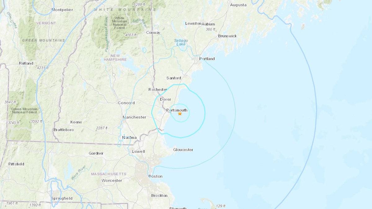
A 3.8 magnitude earthquake originating off Maine's coast surprised residents across the Northeast on Monday morning, causing tremors felt as far south as Boston. The U.S. Geological Survey (USGS) pinpointed the quake's epicenter approximately 6.5 miles southeast of York, Maine, occurring just before 10:30 a.m. Initially reported as a 4.1 magnitude event, the USGS later revised the measurement to 3.8.
The USGS addressed the quake on X (formerly Twitter), stating, "Today's M3.8 near Bar Harbor, Maine, serves as a reminder that while uncommon, earthquakes are not unheard of along the Atlantic Seaboard." The National Weather Service (NWS) in Caribou, Maine, confirmed there was no tsunami risk.

The unexpected tremor prompted a flurry of social media activity, with residents sharing their experiences. One X user from Southern Maine described their house shaking "like a vehicle ran into it." Another user closer to the epicenter reported a "decent jolt" and an initial concern that something had struck their home.
NWS Boston, situated roughly 65 miles south of York, reached out to its followers on X, inquiring whether they had felt the earthquake. Reports of the tremor also emerged from New Hampshire and Rhode Island.
The USGS provided historical context, explaining that New England, including areas as far south as Long Island, New York, has a history of experiencing minor earthquakes, with occasional, more significant events causing damage. According to the USGS, "Moderately damaging earthquakes impact the region every few decades, while smaller tremors are felt approximately twice a year. The Boston area experienced damage from earthquakes three times within a 28-year span in the mid-18th century, and New York City suffered damage in 1737 and 1884."
Comments(0)
Top Comments